
Alaska 2009: Glacier Bay
Glacier Bay National Park and Beyond
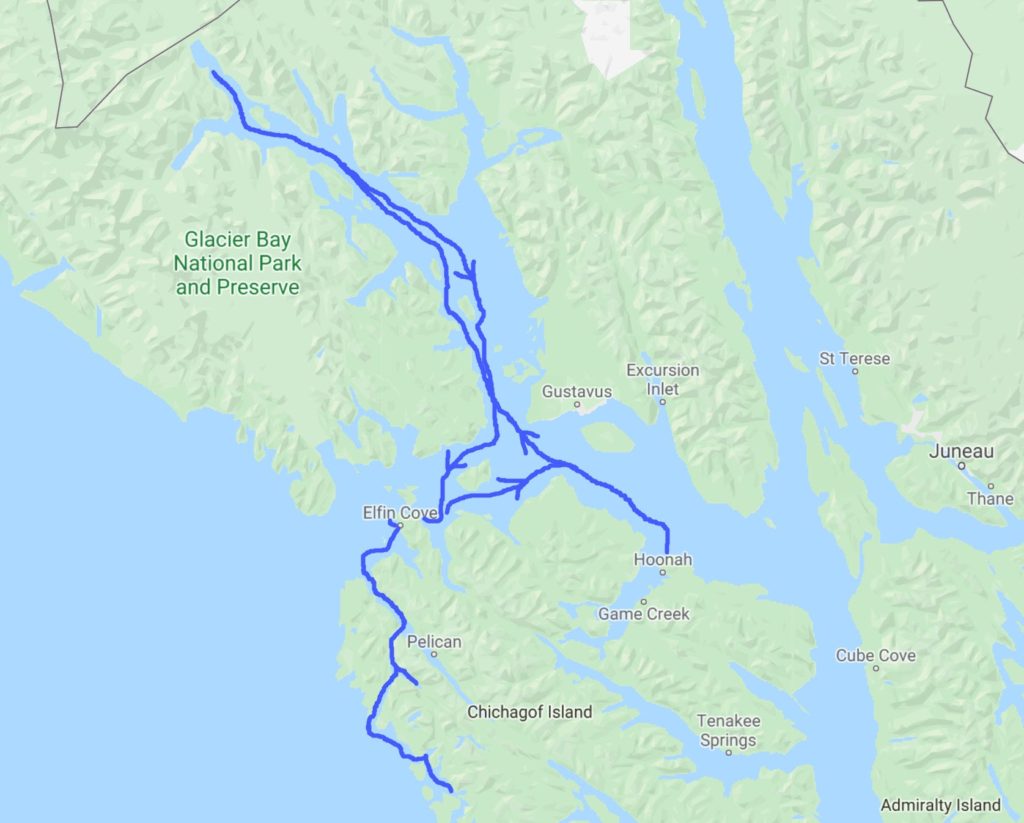
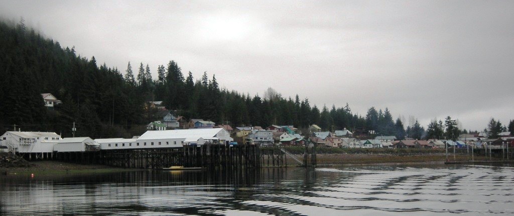
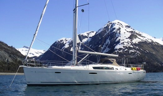
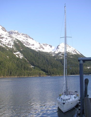
The beautiful weather lasted for days as we worked, repaired, and then prepared the boat for cruising. We met some really nice folks, including a couple from France who have spent much of their life sailing around the world on a catamaran, an Italian guy sailing on his own (eventually towards Antarctica), and a couple who, originally from Tennessee, recently relocated down to Hoonah from Haines Alaska. Everyone had a wonderful attitude and a distinctive accent… we were quite the eclectic crowd. We spend the first days at the dock socializing, hosting guests on board for cappuccinos, and preparing to sail out. Our plan was to head for Glacier Bay National Park, just up Icy Strait and northwest from Hoonah a bit, since a permit is not required to enter the park prior to June 1st and we wanted to go early and miss the “crowds” of summer.
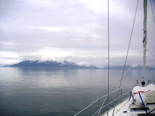
On the misty morning of May 7th, we headed out from Hoonah at the end of the ebbing tide, into Icy Strait and toward Glacier Bay. The waters were calm and the rain held off, so we stayed comfortable and dry. As we passed Point Adolphus (we affectionately call it “Whale Point”) we were delighted to see several groups of humpback whales surfacing and then disappearing underwater again with graceful sweeps of their large tails.
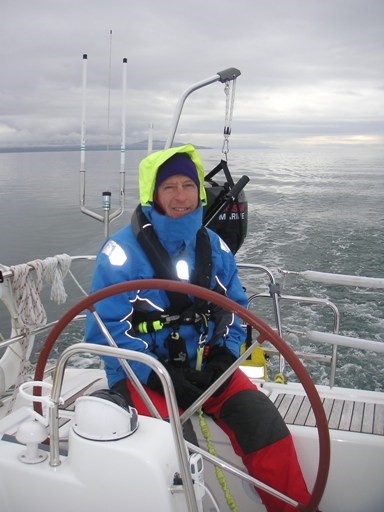
We timed our trip such that the tide changed and began to flood as we entered Glacier Bay. The currents can be very strong, up to 8 knots. Our boat under power usually manages only 7 knots on its own, so this extra “push” would help us travel the 40 or so miles up to the west fork and into Reid Glacier, our first destination anchorage. We were running at about 10 knots, sometimes more, and made good progress.
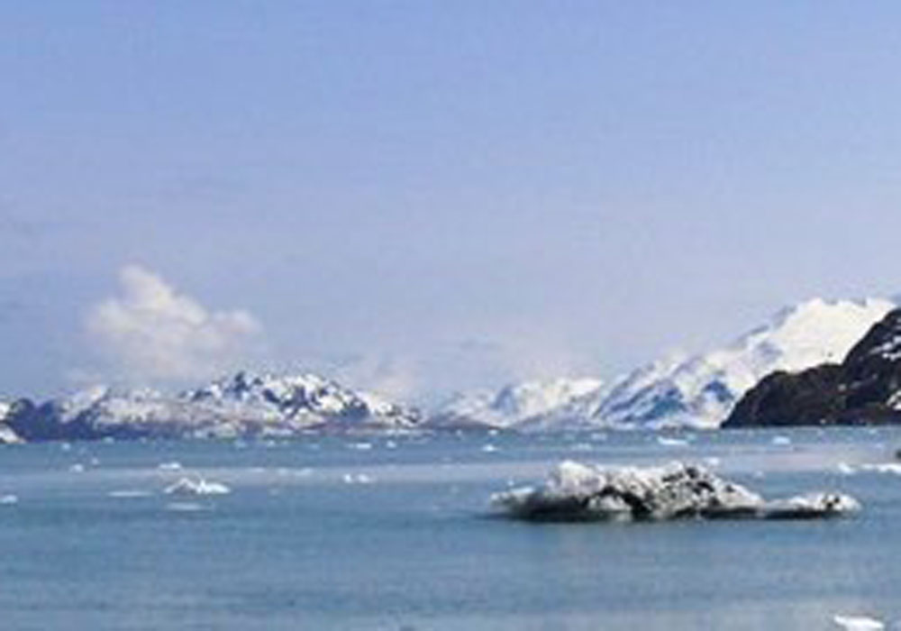
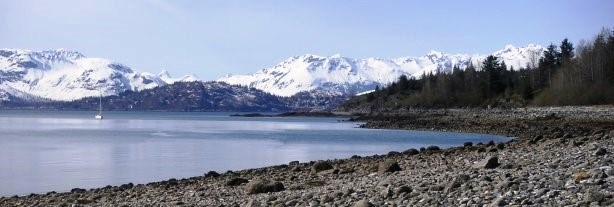
Even in May, the surrounding mountains are snow-covered and cold. The peaks rise from sea level to an impressive 5000 feet in some areas. There are many glaciers that flow into the bay and we were lucky to find an anchorage where we could get very close. Some are dangerous, rising up to 200 feet with huge chunks of ice cleaving and breaking off into the water. You need to be on continuous alert for small icebergs, called “bergie bits” of various sizes floating by.
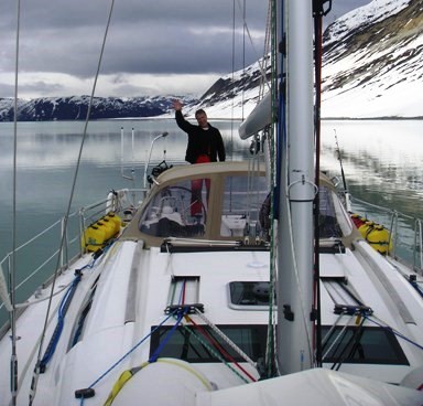

Reid Inlet is beautiful, with the glacier coming right to the water’s edge. As we were anchored, we heard loud cracking sounds and saw the results… chunks of freshly broken-off- ice at the foot of the glacier face. Craig brought several manageable-sized chunks back to the boat and we melted them for drinking water. He was eager to get the dinghy out and motor over to a place on shore where he could do some gold prospecting, a recently acquired hobby. The north point of this inlet used to be a mine, so he was optimistic.
On the first day of searching, he was excited to have found an area where his metal-detector went crazy (that means there’s something metallic in the vicinity and he was hoping it was gold!) On the second morning, he was ready to go and start chiseling away at the granite to get to the prize. He wondered whether he’d have sufficient storage for all the gold he would unearth, and decided to take along a 5-gallon bucket, just in case!

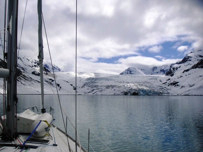
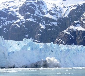
Unfortunately, the bucket came back empty and we packed up to catch the tide on to our next destination. We wanted to head up Tarr Inlet, about 12 miles beyond Reid. At the head of the inlet are two major glaciers. Marjerie, the more prominent of the two, is an amazing glacier which actively juts out into the tidal waters and continues to drops huge chunks of ice into the current. We had to be alert the entire way up and also back down this inlet due to the large amounts of ice floating by. With icebergs, what you see above the water line is only about 10% of the entire mass, so what may seem small could pose quite a threat.
While we were at the face of the glacier, we heard the cracking of ice several times and witnessed ice falling off and crashing into the water. It was an amazing site.
The photos we took simply cannot do justice to the immensity and power behind these huge behemoths. It is simply breathtaking…
As it started getting late and the current began to strengthen, we headed back down Tarr Inlet and toward the center of the Park. We anchored at the head of Tidal Inlet and had a beautiful view of the mountains to our south.
We took the dinghy ashore, and as I started to climb out, I caught my foot on the handle and went halfway into the FREEZING water (one arm up to the elbow and one leg a good 6 inches above where my waterproof rubber boots ended!) No photos of this unfortunate, chilly and bedraggled scene.
It was Sunday morning, May 10th and after having our coffee and breakfast and wishing our Mom’s happy Mother’s Day (in our thoughts only, since we didn’t have any way to call them that day) we took the dinghy to shore and spent some time hiking up the stream bed. Craig used his metal detector in hopes of finding gold. No luck with that, but we did fill our water bottle with fresh clear wonderful refreshing water from the stream and had some beautiful views from above.
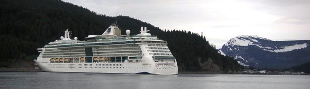
We left Glacier Bay that afternoon, with the ebbing tide and a beautiful sunset. The weather was lovely and the water was calm. As we left Glacier Bay National Park, we set our course west for the Inian Islands at the west end of Icy Strait as our stop over point, just before it opens up into the Gulf of Alaska. Along the way, we encountered whales, seals and otter, and then a very, very large cruise ship heading on a collision course with us. We felt very, very tiny in comparison, but we sat up tall and radioed over to them to let them know our destination and that we’d hold our course until they passed. They radioed back and said thank you. If you ever see the Radisson “Serenade of the Seas”, that was the ship we met up with in Alaska. The approach to Inian Cove in the Inian Islands was quite beautiful with the setting sun. In May, the sun sets at about 9PM in SE Alaska and as we dropped the anchor and started the grill, the sun was just dipping down over the mountains.
On Monday morning May 11th we headed out towards Elfin Cove, a tiny and quaint town of Scandinavian origin. They say there are 20 people living there in the winter time and over 300 in the summer. We fueled up and planned to get supplies from the local store. Fortunately, we had arrived during one of the limited times the store was open, Mondays, Wednesdays and Fridays from 1PM to 3PM… a narrow window of opportunity! The town of Elfin Cove is surrounded entirely by a boardwalk, which provides a scenic 10-minute walk around.

After a brief visit, we headed out toward the Lisianski Inlet. This was also the only time during our trip that we had any cell phone service whatsoever. There was a small spot (only about ¼ mile long) where we had service and we did a few circles to get urgent phone calls through, before heading further down the inlet and then west into the strait. We tied up to a forest service pier for the night, with beautiful views along the strait.

On Tuesday morning May 12th, we caught the ebbing tide and continued south through Lisianski Strait and out into the Gulf of Alaska. The waters were calm and we hoisted the sails heading toward Portlock Harbor through Imperial Pass. We continued on to Kimshan Bay through the very narrow and scenic Surveyor Pass. The sun was out, it was warm, and there was virtually no wind through this very well protected pass, so we put on our sun block and peeled off our fleece to enjoy the ride.
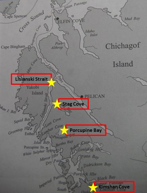
Kimshan Cove is the site of an old gold mine and where many Chinese came to work. Kimshan means “gold mountain” in Chinese. They took over $13 million of gold from these mines and unfortunately didn’t leave any for Craig to find while prospecting there. We trolled for salmon underway, and then while anchored, put out a halibut line and a crab pot. We were not successful in catching anything to eat, but instead we caught our anchor lines with the crab pot line and tangled that with the halibut line. We also had an extra anchor line out to mark the spot where Craig’s camera took an unplanned dive into the water. It is supposedly waterproof to 10 feet, but it was sitting in almost 60 feet at high tide and we were skeptical about it working, even if we could have found it. Despite several attempts, both free-diving and with an air hose, the camera (and unfortunately, all Craig’s wonderful photos) remain in that cove. We had planned to stay there for at least two nights, but that bay didn’t really appeal to me all that well. Even though this area is a complete wilderness, there were several cabins and somehow it didn’t have a good enough “feel” for me to want to stay there for another night. Not when there are so many other wonderful locations to explore.
So, we headed off the next morning back through Surveyors Pass and north toward Porcupine bay, a lovely little area with a waterfall at its head. Well, it might qualify as a sort-of waterfall at low tide, but was nothing more than rapids at high tide with up to 25-foot tides in Alaska, but beautiful and surrounded by snow-covered peaks. We trolled for salmon again and at lunch time caught a rock fish on our hand line instead. Craig expertly filleted it and as soon as we anchored (about a half hour later) we grilled it up for lunch. We thanked and honored the fish for nourishing us and we used every last bit of it… even the remains to bait our halibut line and crab pot. Then we sat in the cockpit, listened to the waterfall, talked, and then napped in the sunshine.
Porcupine Cove with waterfall
Although we had planned to spend two nights in Porcupine Bay, Craig decided that the gold prospecting might be better back up Lisianski Strait in Stag Cove.
So on Thursday May 14th we mounted the outboard back on the boat and set off, towing the dinghy behind us. The weather was cloudy though it didn’t rain along the way.
Stag Cove is nestled deep and long between several mountain peaks. When we arrived at about 4PM it was already noticeably colder. We anchored and settled in for the evening, enjoying some fish we had been given in Elfin Cove and watched a cute movie on DVD through the computer.
Craig was out with the dinghy, exploring and prospecting most of Friday, even though it rained on and off all day. I stayed warm and nestled down below in the cabin, on my computer and then happily, lazily, reading all afternoon. We discovered a book on board that I had been looking for, called “The Law of Attraction” and we have started reading it out loud to one another. It is a guide to helping attract, create and manifest the experiences you want from life.
As we sat together in our beautiful boat, in one of the loveliest places in the world, I couldn’t help but think that we already had a pretty good start at manifesting our adventures and our dreams.
Saturday morning May 16th and it was time to start making our way back to our home port of Hoonah. The weather was still a bit overcast and it could have gone either way. We headed out at about 11AM in order to be through Lisianski Strait and the Inlet in time to catch the flooding tide in Icy Strait and help push us back to Hoonah. The weather stayed favorable and we cruised all the way back, taking the South Inian Pass and then rounding Point Adolphus (Whale Point) to be delighted yet again with several humpback sightings.
As we headed into the harbor towards Hoonah, we were greeted by a huge cruise ship anchored off the point. The town is so small that it is quite something to see such a large ship “parked” out in the front yard!
Back at the dock, we cleaned up the boat and then settled in for our last few days of this trip. On Sunday evening, our new friends came over with a video for us to watch… the blockbuster feature hit movie, “Bear Safety” from the forest service. We made up some popcorn and enjoyed the action-packed film. Since bears outnumber people on Chicagof Island here in Alaska by a ratio of about 30:1, knowing how to identify black bears from grizzly bears and how to handle various types of defensive and offensive bear behavior is quite important.
The weather for the last few days was glorious, and as always, we weren’t ready to pack up and leave for (our other) home. The next trip we make up to Alaska will most probably be our last time in Hoonah, as we plan to begin sailing back down South. But you never know… cruising plans are like writing in the sand at low tide. Somehow, I don’t think we’ll be leaving Alaska too soon or for good!
Stay tuned for further sailing adventures!!!